Books
Magazines
Artwork
Editions
Multimedia
Allied Publishers
Authors
Style
Perla Medley
Posters & Postcards
Antiquarian
Work details:
• Title: Moravia nova et post omnes priores accuratissima delineatio
• Author: Jan Amos Comenius (March 28, 1592, likely Nivnice near Uherský Brod – November 15, 1670, Amsterdam, Netherlands)
• Publisher: Nicolaus Visscher (born Claes Janszoon Visscher, Latin name Piscator; January 25, 1618, Amsterdam – December 1, 1679, Amsterdam)
• Date: 1664 (this print); the original draft was created between 1624 and 1627
• Technique: Original copperplate engraving, 47 x 55 cm
This work represents one of the most significant cartographic monuments of Moravian history. Comenius’s map of Moravia was created as a critical response to the inaccuracies of the older map by Pavel Fabricius (1569). The author began working on it even before his forced exile, but the main revisions and preparations for publication took place while he was in exile (Poland, Sweden, the Netherlands).
Comenius’s activities in exile and Swedish collaboration:
Jan Amos Comenius spent most of his creative life in exile. In exile, he became a European-renowned scholar and advisor on matters of educational reform. His cartographic work, however, also had a profound political and religious dimension. There is historical evidence that Comenius ultimately prepared the map at the instigation of Swedish Chancellor Axel Oxenstierna, and consequently for the needs of the Swedish crown. In the context of the Thirty Years’ War, the map was intended to serve Swedish troops as a strategic basis for military operations in Moravia. Comenius, as a representative of the Unity of the Brethren, placed his hopes in the Swedish intervention for the military defeat of the Habsburgs, the redress of injustices committed against Czech and Moravian Protestants, and their subsequent return to their homeland.
The map’s uniqueness lies in the author’s methodology: although Comenius worked in exile, he achieved extraordinary accuracy thanks to intensive written correspondence with his collaborators and friends directly in Moravia. Through this long-distance consultation, he created a work whose accuracy surpassed all contemporary maps and served as the standard for depictions of Moravia for the next 150 years.
Full Latin text of the dedication and inscriptions:
Title cartouche:
• Latin: MORAVIA NOVA ET POST OMNES PRIORES ACCURATISSIMA DELINEATIO. Auctore I. A. Comenio.
• English: Moravia, newly and most accurately depicted of all previous editions. By J. A. Comenius.
Dedication (top left):
• In Latin:
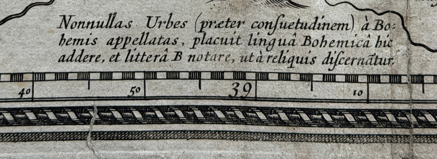
Illustrißo. Do. LAD. WELENIO de Zerotin, Luntenburgi, Treboviae, Hanstadii, et Ruddae Domino, gratissimo Domino meo. Prostant quam plurimae diversarum editionum Chorographicae tabulae Patriae nostrae, Illustrißime Domine, verum mendosißimae omnes: Solus enim quantum sciam, P. Fabritius, olim Ferdinandi Imperatoris Medicus, eam lustratam in Tabulam redegit, reliquae quotquot prodierunt posthaq, ex hac descripte sunt, varys variè illapsis erroribus. Primum enim multa praecipuj nominis loca paßim omittuntur, obscura quandoque reponuntur: Tum appellationes corrumpuntur mirè, et quod maximum est situs locorum et distantie vix usquà sibi constant, ut illarum nullus penè sit usus. Non igitur me cohibui, quin invito hoc otio meo, semel atq. iterum peragratâ ea, et si qua loca pedibus, oculisvè adire et metiri non contigit, hominibus eorundem locorum gnarist exquisitè adhibitis in consilium emendatiorem reddere tentarim, quod jam hic exhibeo. Hic enim jam, primum, Urbes et Oppida: Secundo: Arces, Castella, Monasteria, Pagos insigniores plerosque. Tertio, Montes et Fluvios qui itinerantibus transeundi sût, aut se spectandos offerunt: Thermas item, Metalli fodinas, Officinas vitriarias, Vinetorum colles. Quarto: Et (quod precipuè elaboraram) veriores ubique locorum distantias. Denique, quia pleraeque locorum appellationes aliter Bohemis (quorum sermone major Provinciae pars utitur) aliter Germanis efferuntur, utrasque subinde posui, quo utriusque lingue hominibus Tabula haec usui sit. Quam tibi Magnifice Domine, utpote Patriae Magnati, magnoque Patrono meo, dico, dedico, Deum orans ut quam primum te Patriae Patriamq. tibi magno utrimque gaudio, restituat. Dabam in exilio, Illustrißae Magtiae Tuae addictißimus I. A. Comenius.
In English:
To His Highness, Lord Ladislav Velen of Žerotín, Lord of Břeclav, Třebová, Hohenstadt, and Ruda, my most gracious lord. There are many topographical maps of our country available in various editions, Your Highness, but they are all riddled with errors. As far as I know, only Pavel Fabricius, once the physician to Emperor Ferdinand, drew it on a map based on his own survey; the others, however many were published after him, are copied from this one, and various errors have crept into them. First of all, many place names are omitted everywhere, and sometimes unknown places are listed. Furthermore, names are strangely distorted, and most importantly, the locations and distances hardly ever correspond, making them almost unusable. I could not resist, therefore, despite this unplanned free time, from attempting to correct it. I went through it again and again, and where I was unable to visit and measure certain places personally, I relied on the advice of people familiar with those places to present it in a better state, which I now submit here. Here, then, are first: cities and towns; second, castles, chateaus, monasteries, and most of the more significant villages; third, mountains and rivers that travelers must cross or that are worth seeing; as well as spas, metal mines, glassworks, and vineyards. Fourth (on which I worked the most) are more accurate distances between places throughout. Finally, since most place names are pronounced differently by the Czechs (whose language is spoken by the majority of the province) and by the Germans, I have included both, so that this map may be of use to people of both languages. I dedicate and present this map to you, noble lord, as a leading nobleman of the homeland and my great patron, praying to God that He may return you to your homeland as soon as possible, and your homeland to you, to the mutual joy of both. Given in exile, most devoted to Your Most Illustrious Highness, J. A. Comenius.
Cataloged and in collections:
Due to its international significance, Comenius’s map of Moravia (including Visscher’s 1664 edition) is held in leading scientific and memory institutions around the world:
Domestic institutions:
• Moravian Provincial Library in Brno (the significant Moll Collection)
• National Library of the Czech Republic in Prague
• Map Collection of the Faculty of Science, Charles University in Prague
• Moravian Museum in Brno
• Jan Amos Comenius Museum in Uherský Brod
International institutions:
• Austrian National Library in Vienna (Österreichische Nationalbibliothek)
• British Library in London (British Library)
• National Library of France in Paris (Bibliothèque nationale de France)
• Berlin State Library (Staatsbibliothek zu Berlin)
• Rijksmuseum in Amsterdam (due to the origin of the publisher Visscher)
• National Library of Sweden in Stockholm (Kungliga biblioteket)
• Library of Congress in Washington, D.C. (Library of Congress)
• Silesian Library in Katowice (Biblioteka Śląska)